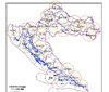
CROPOS – The Croatian Positioning System for precise positioning and navigation using satellites has been launched today after several years of activities for its establishment, in which 13.2 million kuna was invested.
The installation of CROPOS itself is valued at 1.4 million kuna, and in these costs, the European Union participated with 75 percent through the PHARE 2005 program, while Croatia contributed 25 percent. The purpose of the CROPOS system is to enable the determination of position on the territory of the Republic of Croatia in real-time with high accuracy. The CROPOS system consists of 30 reference stations spaced 70 kilometers apart, arranged to cover the entire area of the Republic of Croatia. The stations are interconnected and linked to satellites orbiting in precise orbits, and these connections allow for very precise position calculations according to user requirements.
The operation of CROPOS will be monitored by the State Geodetic Administration. Its director, Željko Bačić, reported that three services are available to CROPOS users. The first, with an error of up to one meter, could be applied in geoinformation systems, navigation, traffic management, environmental protection, agriculture, and forestry. The high-precision service with centimeter accuracy is intended for surveying, cadastre, engineering geodesy, measurement of state borders, aerophotogrammetry, and hydrography.